![](/images/other/stat-length.png)
![Tour Zu Fuß Sankt Oswald bei Plankenwarth - Wanderweg 34 - Photo](https://media.geolcdn.com/t/1900/400/fee6b74c-350d-407e-bbc6-7871ef2279fc.jpeg&format=pjpeg&maxdim=2)
Wanderweg 34
SityTrail - itinéraires balisés pédestres
Tous les sentiers balisés d’Europe GUIDE+
![Länge](/images/other/stat-length.png)
Länge
4 km
![Maximale Höhe](https://static1.geolcdn.com/siteimages/upload/files/1508320355ic_sort_altitude_max_24dp.png)
Maximale Höhe
558 m
![Positive Höhendifferenz](https://static1.geolcdn.com/siteimages/upload/files/1508320355ic_sort_den_pos_24dp.png)
Positive Höhendifferenz
117 m
![Km-Effort](/images/other/stat-length.png)
Km-Effort
5,6 km
![Min. Höhe](https://static1.geolcdn.com/siteimages/upload/files/1508320355ic_sort_altitude_min_24dp.png)
Min. Höhe
433 m
![Negative Höhendifferenz](https://static1.geolcdn.com/siteimages/upload/files/1508320355ic_sort_den_neg_24dp.png)
Negative Höhendifferenz
131 m
![Boucle](https://static1.geolcdn.com/siteimages/upload/files/16400158638029165_repeat_loop_refresh_sync_direction_icon.png)
Boucle
Nein
Kennzeichnung
Erstellungsdatum :
2022-02-16 16:54:36.163
Letzte Änderung :
2022-03-03 13:45:40.277
![Zu Fuß](https://static1.geolcdn.com/sitytour/trail-icons/100.png)
1h16
Schwierigkeit : Einfach
![Scannen Sie diesen QR-Code, um die Tour in der SityTrail-Anwendung zu öffnen](https://capi.geolives.com/qq0zvz2zws4bq2lad0pu/sitytour/trails/3128248/qr.png?size=200)
Kostenlosegpshiking-Anwendung
Über SityTrail
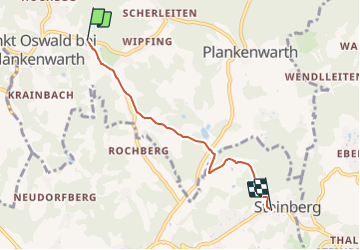
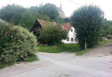
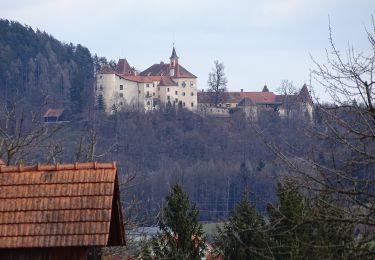
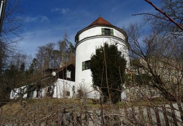
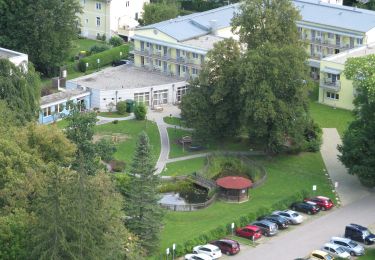
Tour Zu Fuß von 4 km verfügbar auf Steiermark, Bezirk Graz-Umgebung, Sankt Oswald bei Plankenwarth. Diese Tour wird von SityTrail - itinéraires balisés pédestres vorgeschlagen.
Beschreibung
Trail created by ÖTK Sektion Graz.
Symbol: rot-weiss-rot 34
Ort
Land:
Austria
Region :
Steiermark
Abteilung/Provinz :
Bezirk Graz-Umgebung
Kommune :
Sankt Oswald bei Plankenwarth
Standort:
Unknown
Gehen Sie:(Dec)
Gehen Sie:(UTM)
521926 ; 5215014 (33T) N.
Kommentare
Touren in der Umgebung
![Tour Zu Fuß Stiwoll - Wanderweg 13a - Photo](https://media.geolcdn.com/t/375/260/b8af7cfc-f07d-4b58-af01-795c9309e6c6.jpeg&format=jpg&maxdim=2)
![Zu Fuß Zu Fuß](https://static1.geolcdn.com/sitytour/trail-icons/100.png)
Wanderweg 13a
Zu Fuß
Einfach
Stiwoll,
Steiermark,
Bezirk Graz-Umgebung,
Austria
![](/images/other/stat-length.png)
6,3 km | 9,5 km-effort
2h 9min
![](https://static1.geolcdn.com/siteimages/upload/files/16400158638029165_repeat_loop_refresh_sync_direction_icon.png)
Nein
![Tour Zu Fuß Gratwein-Straßengel - Wanderweg 16, Greitherweg - Photo](https://media.geolcdn.com/t/375/260/03ecfe23-aa70-4fce-80ef-8d67606e9e15.jpeg&format=jpg&maxdim=2)
![Zu Fuß Zu Fuß](https://static1.geolcdn.com/sitytour/trail-icons/100.png)
Wanderweg 16, Greitherweg
Zu Fuß
Einfach
Gratwein-Straßengel,
Steiermark,
Bezirk Graz-Umgebung,
Austria
![](/images/other/stat-length.png)
5,9 km | 9,8 km-effort
2h 14min
![](https://static1.geolcdn.com/siteimages/upload/files/16400158638029165_repeat_loop_refresh_sync_direction_icon.png)
Nein
![Tour Zu Fuß Gratwein-Straßengel - Wanderweg 14 - Photo](https://media.geolcdn.com/t/375/260/145e2a83-b263-4a09-9666-7dd5a74a4f9e.jpeg&format=jpg&maxdim=2)
![Zu Fuß Zu Fuß](https://static1.geolcdn.com/sitytour/trail-icons/100.png)
Wanderweg 14
Zu Fuß
Einfach
Gratwein-Straßengel,
Steiermark,
Bezirk Graz-Umgebung,
Austria
![](/images/other/stat-length.png)
3,5 km | 5,9 km-effort
1h 20min
![](https://static1.geolcdn.com/siteimages/upload/files/16400158638029165_repeat_loop_refresh_sync_direction_icon.png)
Nein
![Tour Zu Fuß Gratwein-Straßengel - Wanderweg 12 - Photo](https://media.geolcdn.com/t/375/260/ee0342fc-462c-4384-a09d-1fbd30e783d9.jpeg&format=jpg&maxdim=2)
![Zu Fuß Zu Fuß](https://static1.geolcdn.com/sitytour/trail-icons/100.png)
Wanderweg 12
Zu Fuß
Einfach
Gratwein-Straßengel,
Steiermark,
Bezirk Graz-Umgebung,
Austria
![](/images/other/stat-length.png)
6 km | 9,4 km-effort
2h 7min
![](https://static1.geolcdn.com/siteimages/upload/files/16400158638029165_repeat_loop_refresh_sync_direction_icon.png)
Nein
![Tour Zu Fuß Gratwein-Straßengel - Wanderweg 15, Kalvarienbergweg - Photo](https://media.geolcdn.com/t/375/260/82d83c99-535d-4cdc-a5b1-598223f415be.jpeg&format=jpg&maxdim=2)
![Zu Fuß Zu Fuß](https://static1.geolcdn.com/sitytour/trail-icons/100.png)
Wanderweg 15, Kalvarienbergweg
Zu Fuß
Einfach
Gratwein-Straßengel,
Steiermark,
Bezirk Graz-Umgebung,
Austria
![](/images/other/stat-length.png)
3,9 km | 5,5 km-effort
1h 14min
![](https://static1.geolcdn.com/siteimages/upload/files/16400158638029165_repeat_loop_refresh_sync_direction_icon.png)
Nein
![Tour Zu Fuß Thal - Arnold Schwarzenegger Wanderweg - Photo](https://media.geolcdn.com/t/375/260/27b69a35-96e2-4eaa-92ef-745945ffc9e7.jpeg&format=jpg&maxdim=2)
![Zu Fuß Zu Fuß](https://static1.geolcdn.com/sitytour/trail-icons/100.png)
Arnold Schwarzenegger Wanderweg
Zu Fuß
Einfach
Thal,
Steiermark,
Bezirk Graz-Umgebung,
Austria
![](/images/other/stat-length.png)
6,1 km | 8,3 km-effort
1h 53min
![](https://static1.geolcdn.com/siteimages/upload/files/16400158638029165_repeat_loop_refresh_sync_direction_icon.png)
Nein
![Tour Zu Fuß Gratwein-Straßengel - Wanderweg 30 - Photo](https://media.geolcdn.com/t/375/260/8bed89ec-bb6e-4869-8616-4436e3a08253.jpeg&format=jpg&maxdim=2)
![Zu Fuß Zu Fuß](https://static1.geolcdn.com/sitytour/trail-icons/100.png)
Wanderweg 30
Zu Fuß
Einfach
Gratwein-Straßengel,
Steiermark,
Bezirk Graz-Umgebung,
Austria
![](/images/other/stat-length.png)
6,9 km | 11,9 km-effort
2h 42min
![](https://static1.geolcdn.com/siteimages/upload/files/16400158638029165_repeat_loop_refresh_sync_direction_icon.png)
Nein
![Tour Zu Fuß Gratwein-Straßengel - Wanderweg 1 - Photo](https://media.geolcdn.com/t/375/260/3c33e0c9-492c-487c-a170-2a6ea3f5dba0.jpeg&format=jpg&maxdim=2)
![Zu Fuß Zu Fuß](https://static1.geolcdn.com/sitytour/trail-icons/100.png)
Wanderweg 1
Zu Fuß
Einfach
Gratwein-Straßengel,
Steiermark,
Bezirk Graz-Umgebung,
Austria
![](/images/other/stat-length.png)
12 km | 18 km-effort
4h 5min
![](https://static1.geolcdn.com/siteimages/upload/files/16400158638029165_repeat_loop_refresh_sync_direction_icon.png)
Ja
![Tour Zu Fuß Gratkorn - Wanderweg 1 - Photo](https://media.geolcdn.com/t/375/260/4443fa5c-743e-415a-81ff-f18f30a43f1c.jpeg&format=jpg&maxdim=2)
![Zu Fuß Zu Fuß](https://static1.geolcdn.com/sitytour/trail-icons/100.png)
Wanderweg 1
Zu Fuß
Einfach
Gratkorn,
Steiermark,
Bezirk Graz-Umgebung,
Austria
![](/images/other/stat-length.png)
5,1 km | 8,5 km-effort
1h 55min
![](https://static1.geolcdn.com/siteimages/upload/files/16400158638029165_repeat_loop_refresh_sync_direction_icon.png)
Nein